POLAR VIEW IN THE ANTARCTIC - SERVICES
High-resolution sea ice information

Timely information on sea ice conditions is essential for all types of marine operations in the Southern Ocean. As part of the Polar View services in the Antarctic, acquisitions of synthetic aperture radar (SAR) imagery will provide detailed, cloud free information about sea ice extent and distribution. To ensure accurate and relevant information, data delivery to the ships aims to be within only a few hours of image acquisition.
Frequently ships do use satellite data to help navigation in sea ice. However this data can often be limited by cloud cover and normally has a low (>1km) spatial resolution. Therefore the necessary level of detail is not available since it cannot be resolved or is obscured by cloud.
To complement other forms of sea ice information, imagery from the SAR satellites can provide valuable added detail. Whilst not available on a routine basis for all areas, Polar View can schedule image acquisitions to coincide with a ships planned course.

Once the satellite has acquired the data, it takes only a few hours to process the image and deliver it to the ship in a useable form.
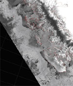
Unlike other satellite image types, this radar satellite image can 'see' through cloud and can be acquired either day or night, as it does not rely on sunlight. This data also has a higher spatial resolution of approximately 100m.
Since the loss of ENVISAT, alternative ASAR imagery is acquired at a regular interval for limited areas. If users require coverage outside of this area, we are happy to plan acquisitions and ensure the best format for delivery and use by personnel on the ship.
The example shown here is of the Antarctic Peninsula, including Adelaide Island in the lower half.
